Showing posts with label Dune Erosion. Show all posts

Thursday, 27 October 2011

Proposed Management Options for Ocean Beach

0 comments

Proposed Management Options for Ocean Beach

Closes: 25/11/2011

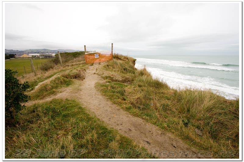
In 2008, the Council appointed a Project Team to gather data and consider management options for Ocean Beach. This followed significant erosion on the beach in June/July 2007, the DCC’s replenishment of sand on the beach and other remedial works as part of a now established ‘holding pattern’, and a comprehensive consultation process. Since then the Project Team has gathered and analysed that data and completed a risk assessment process. It has now identified proposed management options for Ocean Beach, taking into account the existing processes and risks.

A report from Tonkin & Taylor dated October 2011 entitled: ‘Ocean Beach, Coastal Issues and Options’, sets out preferred options for managing the area using an adaptive management approach. The report is available for inspection at the DCC’s Customer Services Centre and Libraries from Tuesday 25 October during their ordinary opening hours. A summary of intent and submission forms are also available. The information, plus background material on erosion at Ocean Beach, can be found at www.dunedin.govt.nz/consultation.

Submissions must be received by 5.00 pm on Friday 25 November. Hearing dates have been scheduled for Tuesday 31 January to Thursday 2 February 2012. Please state in your submission whether or not you wish to be heard.

Consultation documents

Consultation details

Closing date25/11/2011
Contact personBusiness Development Team Leader
Public feedback
  • Online submission form (new window)
  • Email to - oceanbeach.comment@dcc.govt.nz
  • Post to - Proposed Management Options for Ocean Beach, Community and Recreation Services, Dunedin City Council, PO Box 5045 Moray Place, Dunedin 9058, Attention: Lisa Labuchagne
  • Hand deliver to - Proposed Management Options for Ocean Beach, Customer Service Centre, Ground Floor Civic Centre, 50 The Octagon - Attention Lisa Labuchagne
Public meetings

The public meeting is to be held on Monday 7 November 2011 at 7.00 pm.

The venue is the Port Otago Room, first floor, Edgar Centre, corner Portsmouth Drive and Teviot Street.

All interested members of the public are cordially invited to attend. A summary of the options and submission forms will also be available at the meeting

.

Thursday, 8 September 2011

Public to have say on erosion plans

0 comments

The public will be asked to have their say as the Dunedin City Council considers plans to combat erosion at Middle Beach that could lead to a "managed retreat" from the area.

Councillors at yesterday's council community development committee agreed to consult the public on a draft Ocean Beach management plan prepared by consultant Tonkin and Taylor.

The draft plan covered an area stretching 4km from St Clair to Lawyers Head and includes Middle Beach, where serious erosion occurred following severe storms in 2007.

The report recommended continuing the council's holding pattern of monitoring and sand replenishment work - put in place following the 2007 storms - in the meantime.

However, the report also canvassed 13 longer-term options and recommended a managed retreat from Middle Beach and Kettle Park, or construction of an inland buried backstop wall to protect the area, over the next 10 to 50 years.

Initial estimates showed the work could cost between $8 million and $19 million, including a clean-up of the old landfill underneath Kettle Park at risk of being further exposed by continued erosion.

Council community and recreation services manager Mick Reece said he hoped consultation could be completed by the end of this year, with recommendations that followed considered as part of next year's long-term plan hearings.

Detailed information gathered by the council's Ocean Beach project team would also be made public through the council's website to aid the consultation process, he said.

chris.morris@odt.co.nz

Sunday, 1 May 2011

Dune contamination tests done

0 comments
http://www.odt.co.nz/news/dunedin/141606/dune-contamination-tests-done

Friday, 26 November 2010

Arsenic, asbestos found in Dunedin dunes

0 comments

Please read the whole article on the Otago Daily Times Website here.

Mysterious sludge at beach years ago, Dunedin man recalls

From the ODT website By Chris Morris
on Fri, 26 Nov 2010

Revelations the sand dunes at Dunedin's Middle beach are laced with traces of industrial chemicals have jogged memories of a mysterious white sludge for Dunedin man Wayne Campbell.

Mr Campbell (62) contacted the Otago Daily Times this week. after Dunedin City Council staff last week confirmed traces of arsenic, asbestos and other industrial chemicals had been found in the dunes.

The contamination of the seaward side of the dunes was believed to have come from old landfill buried under what is now Kettle Park, although council staff were awaiting more test results to determine the extent of the problem.

Mr Campbell said he could recall coming across a mysterious white substance while fossicking in the landfill as a young boy in the 1950s.

Please continue to read the whole article on the Otago Daily Times Website here.


Tuesday, 3 August 2010

How is Ocean Beach Looking?

0 comments

been three years since the big erosion event, the dunes are still healing, the long term management plan is still being worked on by the DCC . submissions just closed on the John Wilson Drive closure issue, anyone make a submission. I was also alerted to an article in the ODT with thoughts on the future of Ocean Beach.

- Ocean Beach Domain review warranted

ODT Monday 2nd August 2010

John Wilson Ocean Dr should be progressively closed and the area developed, argues Paul Pope, on behalf of the Dunedin Amenities Society.
The closure of John Wilson Ocean Dr has divided opinion over access to the coastal landscape.
The Dunedin Amenities Society has looked at its involvement with the domain over the last 120 years and considered the options for the domain and John Wilson Dr? Dunedin has come full circle with its management of the dunes and has often repeated mistakes from the past.

read more ...

Friday, 16 April 2010

Management of dunes to be decided

0 comments

from the Otago Daily Times
By David Loughrey on Fri, 16 Apr 2010

The future management of Dunedin's "first line of defence" against the ocean, the city's coastal dune reserves, will soon be decided after hearings held this week.

The coastal dunes reserves management plan hearings attracted 52 submissions from groups including Save the Otago Peninsula and the Yellow-eyed Penguin Trust. Ten people attended Wednesday's hearings to speak.

Under the Reserves Act 1977, local authorities are required to develop reserve management plans.

Dunedin City Council staff identified 10 coastal reserves, including at Brighton, Karitane, Long Beach, Ocean View, Waikouaiti and Warrington, to be included.

The idea was to protect and preserve the natural processes of the dunes, and manage natural, biodiversity, scenic and cultural values, while providing for recreation that did not damage those values.

Hearings committee chairwoman Cr Fliss Butcher said a major issue that emerged at the hearing was horses and dogs on Warrington beach.

There was "definitely" a problem with uncontrolled dogs, and their effect on nesting birds.

The issue of horses may be dealt with in a separate process, but the reserve was a recreational area, and horse-riding was a recreational activity.

Other issues included concerns about erosion, something the committee would bear in mind, Cr Butcher said.

She hoped community groups similar to the Tomahawk/Smaills Beachcare Trust could be set up to look after the reserves, with help from the council.

"It's really important," she said of the plan.

"These dunes are our first line of defence."

The committee would deliberate next week, and the plan would go before the community development committee, before being signed by the council.

- david.loughrey@odt.co.nz

Monday, 8 February 2010

Sunny St Clair

0 comments

Glorious Sunny day at St Clair on the 5th.
A bit of a check in with the recovery of the Sand Dunes too below.

Wednesday, 7 October 2009

St Kilda Dunes Fixed

0 comments

Work on the Tahuna Outfall extension Pipe involved the destruction of a section of the sand dunes along St Kilda at John Wilson Drive. (below) a road was built across the face of the dunes to allow easy transport of machinery and pipe laden trucks.

Now that the Outfall Pipe Operation has finished, the Affected Sand dune area has been restored. (pic above)

Wednesday, 30 September 2009

Beaches set for protected status

5 comments

ODT 15th July 2009 by Chris Morris
Beaches set for protected status
Eleven of Dunedin's coastal reserves look set to be given new protected status, at the expense of some recreational rights, in an effort to protect vulnerable sand dune systems.

Under the Reserves Act 1977, local authorities were required to classify the primary use of the reserves they owned. read the rest here

• Kuri Beach (two areas on coastal side of Taieri Mouth Rd)
• Brighton (coastal side of Brighton Rd)
• Ocean View (coastal side of Brighton Rd)
• Island Park
• Ocean Grove (coastal side of Tomahawk)
• Te Rauone
• Long Beach
• Warrington
• Karitane
• Waikouaiti (in the vicinity of Matanaka Dr)

The changes would become part of the council's draft Coastal Dune Reserves Management Plan, due to be released for public consultation in October.

Monday, 7 September 2009

Blackhead Boulder Beach

1 comments

Taken during my 'rock hopping' post about three weeks ago, erosion at Blackhead Beach.
Compare to this post

Pic below a photo I saved off the net sometime in the past, apologies I don't know who took the photo. When there was sand.

Friday, 4 September 2009

Concern at Waikouaiti beach erosion

0 comments
Otago Daily Times By Chris Morris on Fri, 4 Sep 2009

Unusually high tides - including July's king tide - and storms in the past two months had combined to claim 5m of sand dunes, and washed away pine trees and 3500 plantings added over the past three years.

The gap between the beach dunes and nearby Matanaka Dr, running parallel with the coast, had reduced to between 3m and 5m as a result, council parks and reserves team leader Martin Thompson said.

The erosion was worst towards the eastern end of the beach, near the Hawkesbury Lagoon, although some sand had returned - in a process known as accretion - in recent weeks, Mr Thompson said.

Wednesday, 29 July 2009

Work on Moana Rua Rd slip

1 comments

Encroachment by heavy seas checked

ODT By Allison Rudd on Mon, 27 Jul 2009
It was estimates $50,000-$60,000 had been spent at Middle beach in the past few days trying to protect rock mattresses laid at the base of the dunes, which had been exposed by last week's heavy seas, and trucking in sand dredged from Otago Harbour and tipping it down the face of the dunes.He estimated the width of the dunes had decreased by 2m-3m in the past two years.The end of Moana Rua Rd fell away last Thursday, and the face of the dunes was now close to a large fence erected in 2007 to stop people from using a dune-top track which has also since succumbed to the sea.

It was difficult to believe the Moana Rua surf club building had once sat between the end of the road and the beach, he said.

"When we demolished that [in 2001] there was a lot of criticism. People said it would have made a good restaurant. But the area it was sitting on does not exist any more."


Sunday, 26 July 2009

'High Alert' as beach battered

0 comments

full ODT article online here By David Loughrey on Sat, 25 Jul 2009
An ODT online poll was also run

Saturday, 25 July 2009

Is Dunedin's beach erosion a sign of climate change?

0 comments
From a POLL at the Otago Daily Times Sat, 25 Jul 2009
Below are two comments related to the POLL

I have lived in Tomahawk for 35 years from 1960 to 1995 and lived right across the road from the sandhills. During that time I have seen the line of dunes going down to such an extend that I circulated a petition expressing concern at the excessive sandmining that occurred. (I believe it is still going strong). The Ocean Grove Domain Board members rubbed their hands in glee at the goldmine at their doorstep and took no notice of the petition that was signed by 95% of the residents. When we amalgamated with Dunedin I wrote to the Dunedin City Council expressing my concern at the continuing sandmining and the erosion of the dunes. I received an answer from a Mr Archer who wrote that the Dunedin City Council shared my concern and that something would be done as soon it came under the Council's jurisdiction. In 1995 I left Tomahawk, disappointed with the lack of action as the Dunedin City Council despite their promises, did absolutely nothing. I believe that the erosion at Tomahawk beach is not only caused by nature, it also did have a mighty helping hand by the continuing sandmining over so many years

Beach Erosion - Submitted by MikeStk on Mon, 27/07/2009 - 11:19am.
It really doesn't matter whether it's caused by global warming or not - the fact is that peak high tides are eating away the only protection South Dunedin has between it and the Pacific. And all the we really have there is a pile of sand.

It's not like peak high tides like this are not predictable (hint: all the fuss about solar eclipses is a little related, tide tables are readily available). Let's face it if the sand loss continues for much longer we're going to have to build something like a concrete dike from St Clair to Lawyers Head.

As I've mentioned in this forum before I think this is potentially the most pressing problem the council has before it - it's quite scary to read that they've not budgeted anything for the issue - instead we're blowing our piggy bank on vanity projects like the stadium - any sensible local body should have reserves for just this sort of occurrence or should have anticipated the problem and have planned ahead.

Friday, 24 July 2009

Ocean Beach Erosion Update

1 comments

Above: today looking down towards St Clair, below, compare to a series of images over the last 2 years from a similar spot. Although the beach profile is lowered, there does not seem to be such an effect on the St Clair end, with most of the erosion around Moana Rua Road. Also a bit further along where the Tahuna outfall pipe was, has been gouged out more than the rest of the beach .


Above left: pulled back view , right: closer view of the digger work at Moana Rua, where in the last two days they have delivered truckloads of sand over the edge of the road, and replenished sand over the rock mattresses and boulders recently exposed at the base, as seen below:
Two days ago

Above photo taken on Wednesday from the base of Moana Rua Road at Middle Beach, note the scattered boulders on the sand at the base. Also the exposed rock mattresses. Significant lowering of beach profile.
Below left: the digger arrives, and first thing it tasks to is to dig up the scattered boulders on the sand(as seen in pic above)and place them on top of the rock mattresses. They are now all gone. Now, I understand that removing these actually cause more erosion. I was told that this was done at St Clair when they were building the new sea wall. Rocks were removed from the shoreline which caused significant lowering of the beach profile. They are actually needed to retain sand. Any thoughts on this?

Above right: damaged and exposed rock mattresses.
Article "Tides flood roads, erode dunes" at ODT.
Below, today St Clair, a good fill of sand at the base of the sea wall.
Motel progressing well, I think its looking pretty good!

Super high tides

0 comments
Super High Tide at Brighton below, with a green wave breaking through the channel between Barneys and the beach. below again, a set at high tide surges up the beach.


Above double-time pic at Brighton looking down the creek to the beach, bottom image is a super high tide last year, same day the whale was beached at Ocean View. And above, a few days ago
Below: left Back Beach around from Brighton in May 2008, nice wide sand beach. Right, a few days ago photo taken from a bit further down the beach.


Above biting in to the dunes again last year.
Below: taken from back beach looking towards Taieri Mouth a few days ago.


Wednesday, 22 July 2009

Blackhead Sand Levels

1 comments

Yesterday at pretty much high tide.
Below, erosion occuring at Blackhead the same time the beach was washed out at St Clair and St Kilda with that series of south east storms/ beach emergency.


Above: a few weeks later, and then Right & Below: three months later.

Below: December same year, 2007

Below: April 2009.

Wednesday, 15 July 2009

Beaches set for protected status

0 comments

Otago Daily Times
By Chris Morris on Wed, 15 Jul 2009
Eleven of Dunedin's coastal reserves look set to be given new protected status, at the expense of some recreational rights, in an effort to protect vulnerable sand dune systems.

The move would see coastal reserves next to beaches at Long Beach, Ocean View, Warrington and Karitane, and seven other locations, reclassified.

Under the Reserves Act 1977, local authorities were required to classify the primary use of the reserves they owned.However, councillors at yesterday's community development committee meeting voted to approve the reclassification of 11 coastal reserves around the city from recreational areas to "local purpose (coastal protection)" zones.

Subject to final approval at the next full council meeting in August, the changes would become part of the council's draft Coastal Dune Reserves Management Plan, due to be released for public consultation in October.The new plan laid out the future rules governing work to protect dunes at Dunedin beaches.

To be protected

• Kuri Beach (two areas on coastal side of Taieri Mouth Rd)
• Brighton (coastal side of Brighton Rd)
• Ocean View (coastal side of Brighton Rd)
• Island Park
• Ocean Grove (coastal side of Tomahawk)
• Te Rauone
• Long Beach
• Warrington
• Karitane
• Waikouaiti (in the vicinity of Matanaka Dr)

Wednesday, 25 February 2009

Healing Sands

0 comments

Time heals all wounds, nature is taking its' course in replenishing the sand at Ocean Beach.

Latest report from the DCC over the Ocean beach public consent process over at my other blog Save Ocean Beach

Tuesday, 10 February 2009

Cam-Era Webcams by NIWA at Ocean Beach

0 comments
Cam-Era – St Clair A

Cam-Era – St Clair B

Updated every 30 minutes... but unfortunately they seems to be published two hours after being taken.

from NIWA website
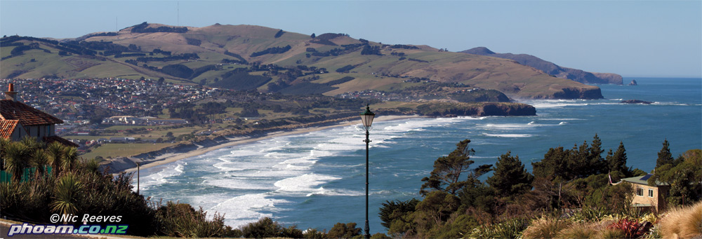
Ocean Beach is a 3 km long sandy bay in south Dunedin running from the St. Clair headland in the west to Lawyers Head in the east. The beach, located just 4 km from the centre of Dunedin city, is the main recreational beach in the region, being popular for surfing, swimming, and walking. At St. Clair, the Esplanade is popular with visitors for the numerous restaurants and cafes, while in the centre and eastern end of the bay the former back dune environment has been developed into sports fields and golf links.

The beach faces due south, and is exposed to the dominant south westerly winds blowing off the Pacific Ocean and frequent high energy southerly storm events. Sand is transported to Ocean Beach by a prevailing southerly current and the dominant southwest swell conditions.

In pre-European time, the Ocean Beach area was characterised by small sand deposits at the western end, increasingly large sandhills to the east, and a hinterland dominated by a lagoon and swamps. As early as 1876 sand was being removed from the dune to fill the low-lying hinterland to meet the growing needs for housing in the developing city. There has also been a long history of coastal erosion issues at Ocean Beach: breaching of the dunes producing sea flooding in the low-lying hinterland suburbs was reported in the 1880s and 1890s; a seawall has been present at St. Clair since 1888; and dune stabilization using brush fences and marram plantings was first started in the 1890s. These erosion issues have continued at periodic times over the last 100 years, with episodes of rapid dune erosion being interspersed with periods of stability and dune growth. The last major erosion episode occurred in 2007, when up to 20 m of dune retreat was experienced, and an estimated 200,000 m3 of sand was removed from the dunes and beach. As a result of this erosion, the DCC were forced to undertake emergency works to protect both public and private assets.

As a consequence of the 2007 erosion episode, the DCC have embarked on an investigations programme to better quantify the nature and magnitude of the coastal processes operating within Ocean Beach, which will allow better decisions on future beach management to be made. The Cam-Era project is part of this investigations programme, producing much needed real time information on wave conditions, movements of rip currents, and beach responses. Without the Cam-Era site, this type of data would only be available from irregular visual observations, photographs, and beach surveys, none of which are able to supply a continuous picture of coastal processes and beach responses.


phoam surf blog Copyright © 2008 Black Brown Art Template by Ipiet's Blogger Template